January 5, 2024

Sols 4059-4061: New Year, Old Challenges

Written by Susanne Schwenzer, Planetary Geologist at The Open University
This image of the Curiosity rover looking back at a field of rocks and distant hills was taken by its Left Navigation Camera on Sol 4057.

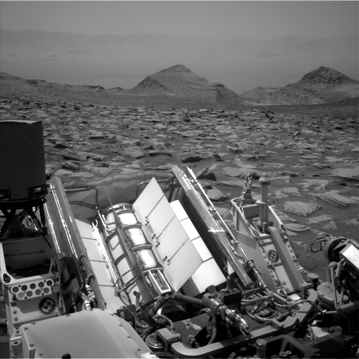
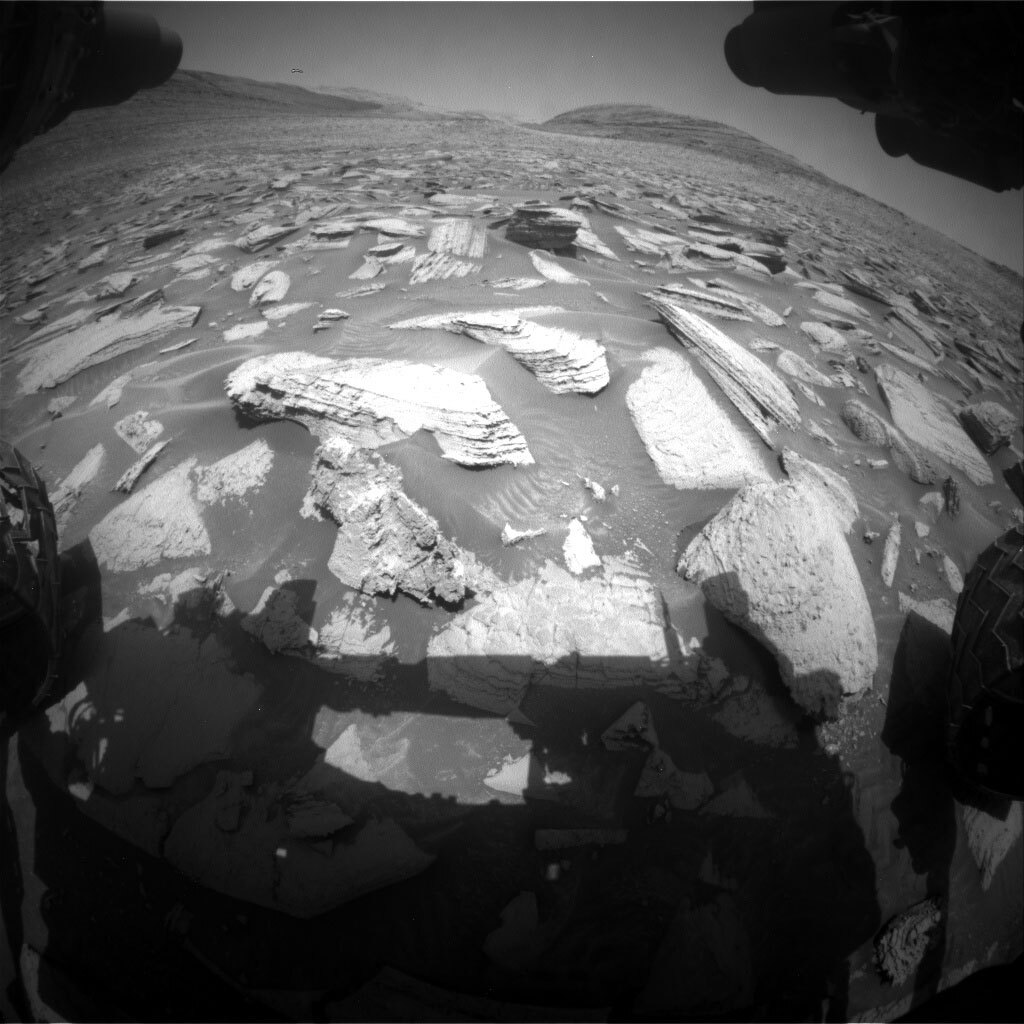
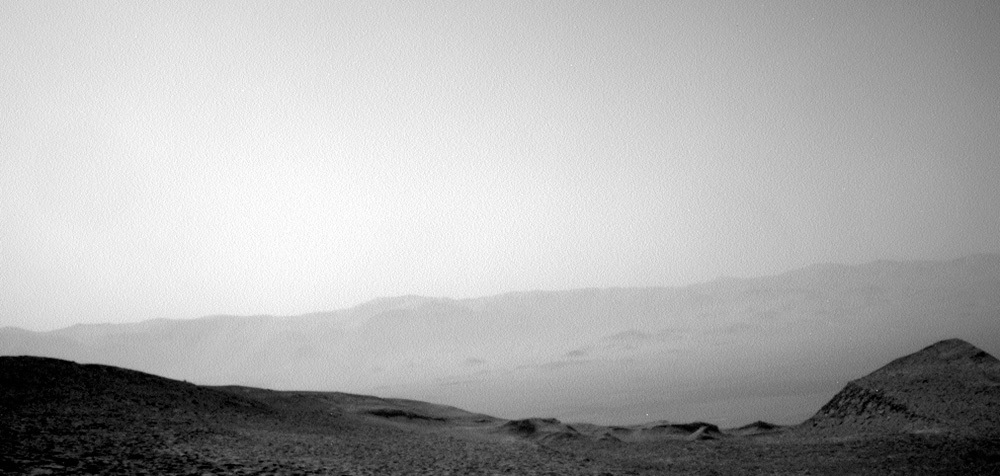
Looking back: this image was taken by Left Navigation Camera onboard NASA's Mars rover Curiosity on Sol 4057. Credits: NASA/JPL-Caltech. Download image ›

Earth planning date: Friday, January 5, 2024

Coming back after the new year celebrations it was my first Curiosity planning as Geology Science Team Lead (GeoSTL) today. Of course, I hoped for an easy start… but somehow, everything seemed to have other ideas! First things first, we didn’t have some of the usual images available on the system we use for planning. This was resolved swiftly by the engineers, but of course, even swift magic takes some time. With limited images on the system, everything gets slower. As the GeoSTL, it is on me to watch out for the timing and what colleagues from the instrument teams can and cannot do in such a situation, which was at first just: wait. The fabulous team sprung into action the very moment we had all the images available, and we made it to the finish line in time with an exciting plan.

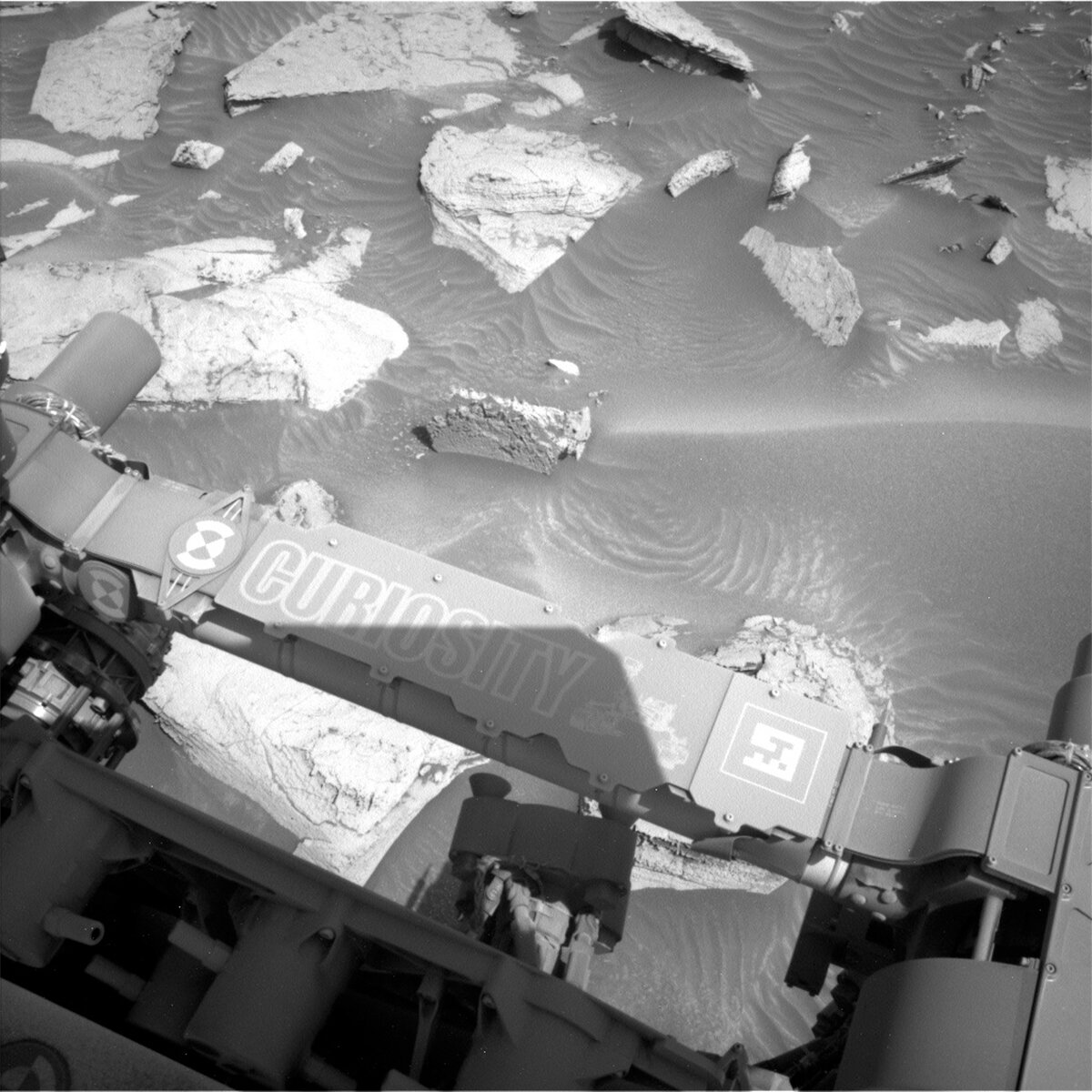
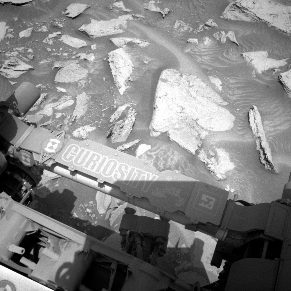
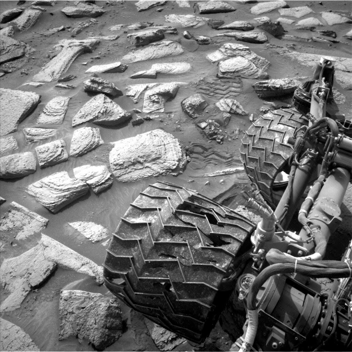
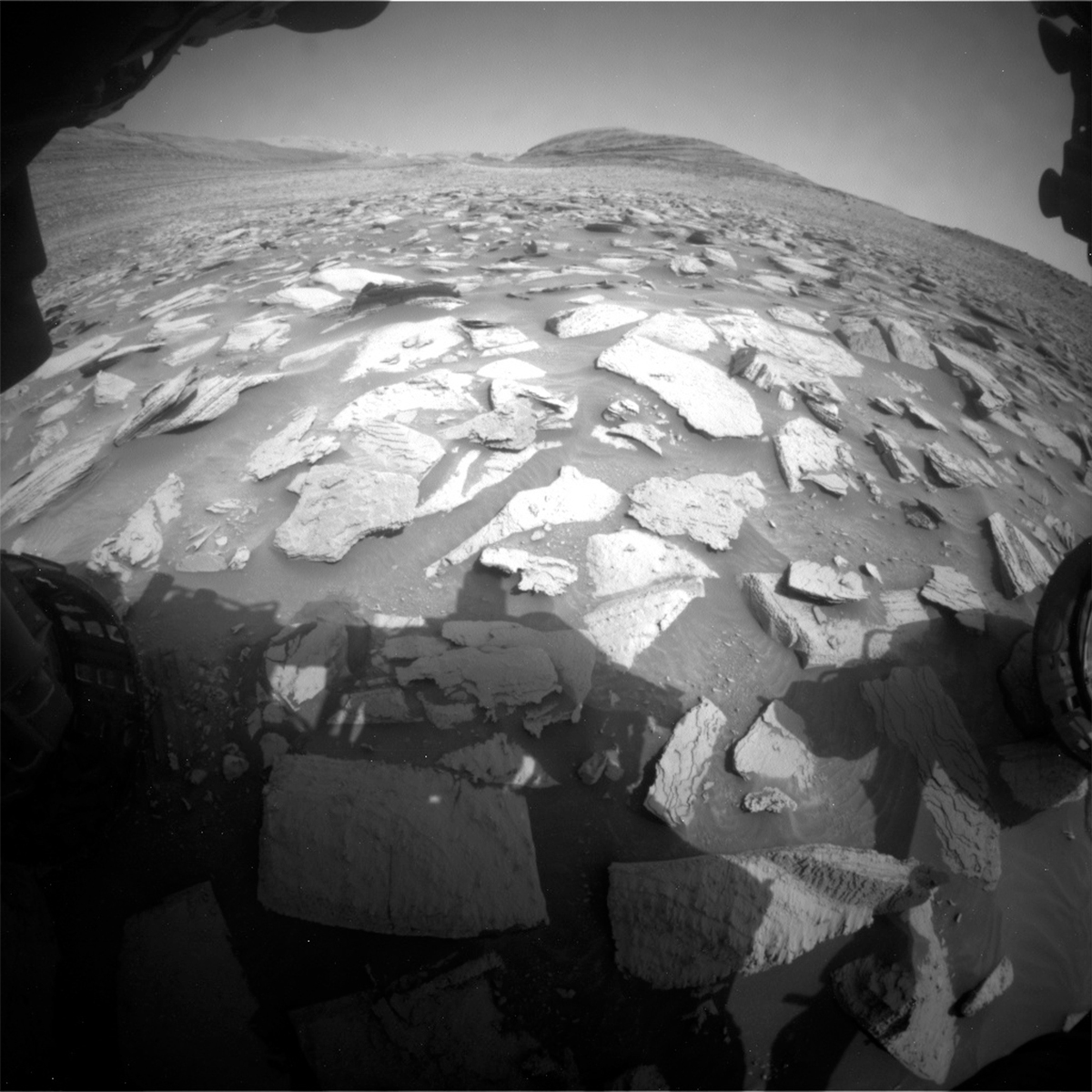
But halfway through our planning, we learnt that not just our systems were a bit temperamental, also Mars had other ideas. A crushed rock under one of the wheels left the vehicle unstable. Hence, we could not risk putting the arm out, and APXS and MAHLI get a break. That prompted another delay in our planning as we paused for discussion, if we wanted to drive off to the next location anyway, or if the target in front of us is important enough to just wiggle the rover — rover drivers call this a bump — to get off the offending rock. After intense discussion, we decided to stay at the target. So, next week’s team will have a familiar workspace in view!

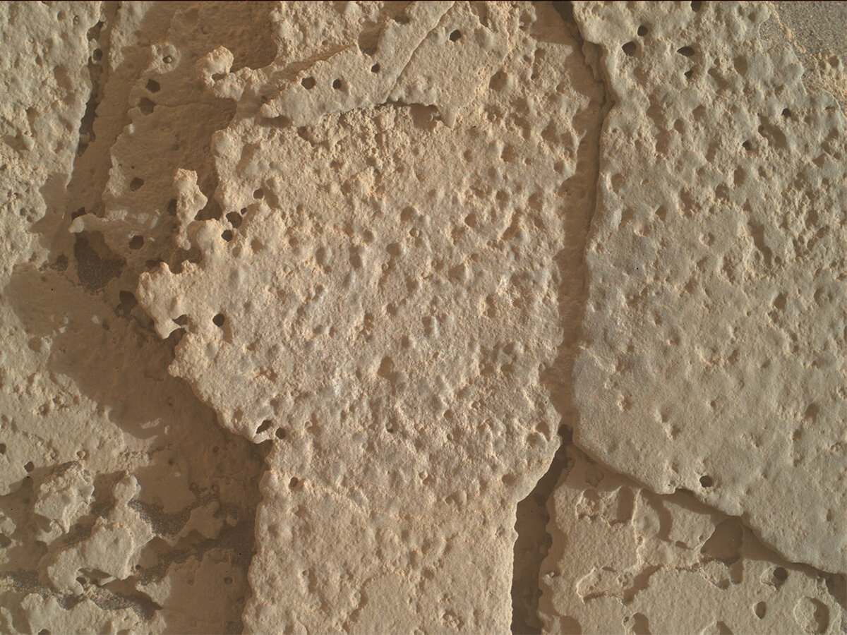
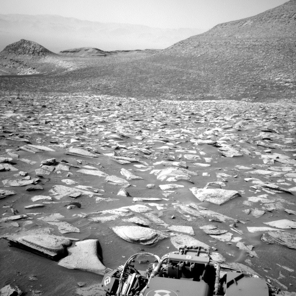
That doesn't mean Curiosity can be dozing off, as there is plenty to do for the other instruments! ChemCam has two LIBS targets one called “Temple Crag” and the other “Cirque Crest,” which together will give us more insight into the chemistry at this location. ChemCam also has two long distance imaging activities, one on the yardang unit high up on the mountain, and one closer to the rover but along the planned drive path, to see the details of this interesting area. If you look closely at the images we have, you’ll see blade-like features, cracks in the rocks, and of course the layering and lamination that accompanies us for most of the mission. Here is a good example of the many things we see in the scene. Plenty to image!

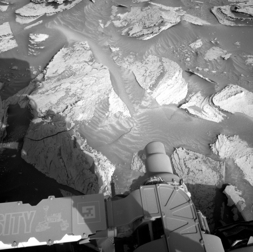
Mastcam has a variety of mosaics in the plan, looking at all these diverse features in colour and great detail, too. In total there are three major Mastcam activities, which serve to expand the workspace and understand the path ahead. Of course, there is also plenty of other activities, including looking at water in the underground with a DAN passive observation, atmospheric observations, and of course data management. It’s easy to forget that those data management and ‘get data’ activities happen, unless they don’t of course, because without them we can’t see what the rover was doing. So, plenty to do for Curiosity, even without the option to do APXS and MAHLI.

For our team, it was a historic day, though, as one of our members estimated she was celebrating her 4000th planning sol, while at the same time we had a member of the team serving in a new role for the first time! Congratulations to both! And thinking of history, I am sure those colleagues (and there are a few, at least one of them also on today’s planning), who started their Mars rover operations career on the Mars Exploration Rover Spirit will remember 20 years (and one day) ago: Spirit landed on Mars on the 4th of January (UTC) 2004. I will remember the landing party… from a distance and as a fan! Go, Spirit, go!

January 3, 2024

Sols 4056-4058: "Ringing" in a New Year

Written by Scott VanBommel, Planetary Scientist at Washington University
This image was taken by Left Navigation Camera onboard NASA's Mars rover Curiosity on Sol 4054.

This image was taken by Left Navigation Camera onboard NASA's Mars rover Curiosity on Sol 4054. Credits: NASA/JPL-Caltech. Download image ›

Earth planning date: Tuesday, January 2, 2024

Curiosity was busy over the holiday break, working independently through 11 pre-planned sols. As Earth transitioned into a new year, dawn broke once again on Mars, and Curiosity awaited a call in the form of a fresh set of instructions. The return to planning for Curiosity’s science team today was not immune to plot twists and suspense. While the planned drive at the end of the holiday plan came up a little bit short, the operations team received word as we were finalizing the plan's activities that our intended connection through the Deep Space Network (DSN) would not be viable due to an issue with the DSN. Curiosity’s team pivoted swiftly, converting the three-sol plan into a two-sol plan with the intention of relaying commands via a satellite orbiting Mars on what would have been the first sol of the original plan. Representing APXS tosol, I was waiting for the ball to drop as to whether or not this plan change would include APXS. In the end, however, the team was able to secure another path through the DSN to transmit Curiosity’s commands. As a result, the original three-sol plan was preserved, and Curiosity was set to receive its first “call” from Earth this year as originally planned.

The three-sol plan focused on removing dust from the surface of a rock face in two locations, “Wanda Lake” and “Green Pass” (located on the bright-looking flattish part of the rock to the left of center in the image), before capturing images with MAHLI and conducting geochemical analyses with APXS on each spot. Curiosity also utilized ChemCam to analyze the targets “Chimney Lake” and “Onion Valley.” Targets imaged in the plan included “Isosceles Peak” and “Texoli” by ChemCam and “Sawtooth Peak” and "Onion Valley" by Mastcam. A monthly SAM checkout and a short ~6 m drive rounded out the main activities in the plan.

December 27, 2023

Sols 4045-4055: This Plan is STUFFED

Written by Michelle Minitti, Planetary Geologist at Framework
This image was taken by Left Navigation Camera onboard NASA's Mars rover Curiosity on Sol 4044.

This image was taken by Left Navigation Camera onboard NASA's Mars rover Curiosity on Sol 4044. Credits: NASA/JPL-Caltech. Download image ›

Earth planning date: Friday, December 22, 2023

Many of us over the holidays like to celebrate with friends and family over a lengthy meal, looking back over the year that has been, and forward to the year to come. Curiosity’s holiday plans could be thought of as similar, albeit instead of food, with a steady diet of science. The eleven (!) sol holiday plan is built like a finely-constructed gourmet meal: full of quality, well-paced, and extremely satisfying.

Sols 4045-4048 are our aperitf, an opening sip of regular REMS and RAD measurements across the Martian day and night. On Sol 4049 we enjoy appetizers both atmospheric and geologic to sate all tastes. DAN passive will run in two long blocks, APXS will sample the argon in the Martian air, Mastcam and Navcam will assess the amount of dust in the air, and Navcam will look for clouds. The delightful looking structures of "Crescent Meadow" and "Sawtooth Peak" will be captured by Mastcam in large mosaics, and we will get our first look at the sand ripple target "Tubatulabal," which will also show up later in the menu.

We scarcely have time to recover from the wondrous variety of the main course before dessert arrives on Sol 4054. Dessert has something for every sweet tooth. We will image Tubatulabal again to see how the wind has moved the sand from our appetizer imaging effort, and ChemCam will analyze the layers of the "Iceberg Lake" target. We get a bit of a break partway through the course to get up and stretch our legs with a short drive to Crescent Meadow. But after the drive we get a few more sweets with a MARDI twilight image, another taste of atmospheric argon by APXS, and Navcam and Mastcam dust and cloud observations.

Sols 4050-4052 are our palate cleanser with plentiful but wafer thin REMS and RAD blocks giving us a break before the main course on Sol 4053. The main course is an extravaganza of atmospheric, targeted, and contact science, full of rich complexity. We start with Navcam dust devil movies, move to ChemCam on "Red and White Mountain," one of the intriguing ridges cutting the workspace bedrock, and then to a long distance ChemCam RMI mosaic on our ever-looming friend, the Gediz Vallis Ridge. MAHLI and APXS join the feast with paired analyses on another one of the workspace ridges, "Lewis Creek," and a variegated gray and red layer in the workspace, "Moose Lake."

Sol 4055 wraps up the meal up with a disgestif of REMS and RAD that will also serve as a toast to the new year. The next time we build a plan, it will be 2024! To Curiosity and her whole team - salute!

December 20, 2023

Sols 4043-4044: Still Hanging in There

Written by Alex Innanen, Atmospheric Scientist at York University
This image was taken by Front Hazard Avoidance Camera (Front Hazcam) onboard NASA's Mars rover Curiosity on Sol 4042.

This image was taken by Front Hazard Avoidance Camera (Front Hazcam) onboard NASA's Mars rover Curiosity on Sol 4042. Credits: NASA/JPL-Caltech. Download image ›

Earth planning date: Wednesday, December 20, 2023

It was a bit of déjà vu today as we arrived to find that we weren’t successful in getting out of the wheelie. In fact, we’re in almost exactly the same position we were on Monday, and our wheel is still off the ground. This meant more remote science for us. As the ENV theme lead, that doesn’t change my plans very much – all of our science is remote! On the geo side, a bit more thought was needed as to what would replace the contact science. Luckily there’s still plenty to look at in our current location, as you can see from the HazCam image above.

Like yesterday, ChemCam and Mastcam are getting workouts, and a lot of targets got new names. ChemCam has two LIBS targets – ‘Big Pothole Lakes’ and ‘Bighorn Plateau’ – as well as another four mosaics – ‘Enchanted Gorge,’ ‘Texoli’ and ‘Big Wall’ as well as continuing to look at the upper Gediz Vallis Ridge. Appropriate names for a big day of planning! Mastcam is joining in on the big fun with mosaics of the two LIBS targets and a couple targets of their own – ‘Silver Maiden’ and ‘Ouzel Creek.’

On the ENV side, we’re taking advantage of the dusty season to hunt for dust devils. We’ve got a dust devil movie and survey in the plan, as well as a tau observation to monitor how dusty the atmosphere is getting overall. An advantage of our déjà vu plan is we got a little extra power, which meant we could extend the dust devil movie and add in a suprahorizon movie. Usually, we use these movies to look for clouds, which tend to be a bit sparser at this time of year. But the suprahorizon movie sometimes gets "photo-bombed" by dust devils, which is like getting two observations for the price of one!

December 18, 2023

Sols 4041-4042: Rocker-Bogie Around the Marsmas Sea

Written by Natalie Moore, Mission Operations Specialist at Malin Space Science Systems
This image showing two of Curiosity's wheels and their tracks on the rocky Mars surface was taken by Left Navigation Camera onboard NASA's Mars rover Curiosity on Sol 4040.

This image was taken by Left Navigation Camera onboard NASA's Mars rover Curiosity on Sol 4040. Credits: NASA/JPL-Caltech. Download image ›

Earth planning date: Monday, December 18, 2023

On the 4040 sol of Marsmas my downlink gave to me, a faulted drive and a wheelie! That’s right, folks, we’re popping Christmas-sized wheelies this year, bigger than we’ve ever seen before! It’s a little hard to tell from the Navcam perspective, but the cover photo above shows our right-middle wheel (bottom in image) completely off the ground in suspension. You can see why, too, with all the thick and pointy rocks everywhere. But don't worry, our rocker-bogie wheel suspension system allows us to pop wheelies without too much concern over rover stability. Even in extreme cases like this, getting us into a more stable position for continuing on is mostly a procedure of backing up, turning a bit to change headings, and continuing forward with lots of care (aka commanding strict limits on how far the rover can stray from the planned path). The biggest downside to mobility faults from wheelies is the inability to unstow the arm, which was the case we found ourselves in this morning.

While we were unable to use any arm instruments today, we took advantage of the free time and planned an excess of remote science instead. Today my job was commanding the Mastcams, so this was a pretty busy plan for me! As soon as we found out about the wheelie, my team basically told me to expand all our mosaic ideas as much as I could handle. Thankfully I got plenty of sleep last night, so I was able to sequence 125 high-resolution frames that will help us plan future contact science sites and drive locations (as well as serving many on-going stratigraphic and sedimentology studies). ChemCam is also allowed with the arm stowed, so they planned a whopping four RMI mosaics as well as two LIBS targets. And since there was even more time available, our environmental team planned a large dust devil movie with Navcam before driving away.

Plans like this can be exciting when you work on a mast-mounted instrument like me, but they ultimately mean less APXS and MAHLI data in the short term. We’ll try again to plant all our wheels on the ground for Wednesday planning, but until then the rover will be using its many eyes quite a bit. Hear that, Mars? We image you when you’re sleeping, we image when you’re awake, we assess if you’ve been bad or good so be good for goodness sake! If only we could ship coal to Mars. Merry Marsmas to all, and to all some hematite.

December 15, 2023

Sols 4039-4040: A Soliday Before the Holidays

Written by Conor Hayes, Graduate Student at York University
A Navcam image of the northern rim of Gale Crater. Now that we've entered the Martian dusty season, we expect that this view will get hazier in the coming months as dust activity picks up.

A Navcam image of the northern rim of Gale Crater. Now that we've entered the Martian dusty season, we expect that this view will get hazier in the coming months as dust activity picks up. Credits: NASA/JPL-Caltech. Download image ›

Earth planning date: Friday, December 15, 2023

Planning can often be a very careful balancing act, and today was certainly no exception. Because we are heading into the weekend, we'd usually get three sols to do all of our science. However, because there is a "soliday" in this plan to help re-synchronize Earth time and Mars time, we're actually only getting two sols. On top of that, we came into planning with slightly less power than we were expecting, meaning that we had less flexibility about how much additional time we could ask for. It was also initially unclear whether or not we had parked somewhere that would allow us to use the rover's arm, but our hard-working rover planners eventually concluded that we were safe to get up close and personal with today's workspace.

This very busy plan begins with a ChemCam LIBS of a bedrock target named "The Thumb" (after a mountain in California near the Nevada border). ChemCam RMI will then take a mosaic of "Cap Rocks" back in the direction of the Marker Band that we crossed about 230 sols ago. Mastcam will document the LIBS results on The Thumb, take a mosaic of some disrupted bedding that was initially identified from orbit, then take some images of the area that we will be driving towards.

After that set of remote sensing observations, we will then unstow the arm for some contact science on two targets: "Four Gables" and "Arrow Peak." This includes briefly touching both targets with APXS, using DRT on Arrow Peak, then taking some close-up MAHLI images of both. After sunset, both targets will get a nice long APXS integration.

When we wake up on the second sol of this plan, we'll start by taking four Navcam images of the north crater rim to characterize the amount of dust in the crater. Navcam will then take a series of short movies looking for dust devils all around us. ChemCam then turns on in preparation for a sequence of activities, including a LIBS of the APXS target Arrow Peak, an RMI mosaic of the Upper Gediz Vallis Ridge from a new angle, and a series of passive spectra to measure the atmospheric composition. This block of observations wraps up with Mastcam documentation of the LIBS on Arrow Peak and a mosaic of "Polemonium Peak." Overnight, APXS will take some atmospheric measurements to complement those taken by ChemCam earlier in the sol.

Just a few hours before we hand over into the plan that we'll build on Monday, Curiosity wakes up for some early-morning environmental science observations, including Navcam and Mastcam imaging to measure dust above and within Gale, as well as a pair of movies to monitor any clouds that may be lingering now that we've moved out of Mars' cloudy season and into the dusty season.

December 14, 2023

Sols 4037-4038: Watch Your Step!

Written by Scott VanBommel, Planetary Scientist at Washington University
This image of the Mars surface with the rover visible in the edges of the frame was taken by Front Hazard Avoidance Camera onboard NASA's Mars rover Curiosity on Sol 4035.

This image was taken by Front Hazard Avoidance Camera onboard NASA's Mars rover Curiosity on Sol 4035. Credits: NASA/JPL-Caltech. Download image ›

Earth planning date: Wednesday, December 13, 2023

With the colder months upon those of us in the Northern Hemisphere, some may be thinking about warmer times ahead, be it the return of spring, or a vacation to briefly thaw out from winter. The arrival of winter spells colder temperatures and fewer daylight hours, along with bouts of snow and ice for many. Slippery conditions make for more challenging commutes, not only on the roads but by foot as well. Many a bare hand has found itself placed in cold snow in an effort to stabilize feet flaring erratically in an often-futile effort to maintain balance on a sheet of ice. I can attest to this.

Curiosity found itself in a similar situation entering today’s planning. There was no sheet of ice. And while it is cold (though Curiosity is rapidly approaching spring equinox in the Southern Hemisphere, occurring almost exactly a month from now), the situation in today’s plan was one of questionable “footing.” The assessment of rover stability by Curiosity’s remarkable Rover Planners determined that outstretching the arm could result in the end of the arm dropping by up to ~5 cm. This could potentially place APXS in contact with nearby sand or result in a collision between MAHLI and the surface if it occurred during a sequence of close-up images. The decision was therefore made to forgo APXS on the target “Potluck Pass” (the darker toned rock in the center of today’s image, seemingly sitting atop other lighter toned rocks) and restrict MAHLI to images acquired at least 10 cm above the same target. Curiosity’s team were not going to risk a potential “hand in the snow.”

Curiosity started sol 4037 with observations by ChemCam on “North Guard” and “Texol,” and by Mastcam on “Crabtree Meadow” and North Guard. MAHLI then acquired images from a safe distance of Potluck Pass before the rover commenced a short (~11 m) drive while monitoring the subsurface with DAN. Near the end of the drive, Curiosity acquired the requisite images to support analyses by APXS and MAHLI in the 4039 plan. Environmental monitoring activities in the evening included dust devil monitoring and a MARDI image. The second sol of the plan included an autonomous ChemCam analysis of a target the rover deemed most worthy and two Navcam movies. Curiosity then completed a CheMin empty cell analysis and more DAN measurements to round out the two-sol plan. Shortly after dawn breaks on sol 4039, Curiosity will pick up where it left off, and hopefully find itself on firmer footing for a two-sol soliday weekend plan.

December 11, 2023

Sols 4035-4036: A Rinse and Repeat Kind of Plan!

Written by Catherine O'Connell-Cooper, Planetary Geologist at University of New Brunswick
A MAHLI image of “Wren Peak," a pitted rock feature on Mars, before brushing.

A MAHLI image of “Wren Peak” before brushing. Credits: NASA/JPL-Caltech/MSSS. Download image ›

Earth planning date: Monday, December 11, 2023

Today’s 2-sol plan was a “Touch and Go” plan, where we do some short science activities (ChemCam and/or MAHLI and APXS) in our workspace early in the morning and then drive to a new workspace. Unfortunately, due to a minor issue with the arm, the weekend plan only partially executed. As Susane reported on Friday, we had planned to DRT the dark toned “Wren Peak” target, take some MAHLI images of the brushed spot, use APXS to analyze the DRT spot and then take some ChemCam LIBS of nearby target “Fish Springs.”

Luckily, this issue was one that the rover planners (RPs) were able to understand quite quickly. We planned to recover these activities which made planning relatively straight forward this morning, as it was just a repeat of parts of the weekend plan. The DRT and some of the planned MAHLIs did execute in the weekend, so APXS and MAHLI asked to complete the activities on the now brushed Wren Peak. This target has a cool, holey texture that looks a bit like some kind of Swiss cheese... Martian style! (see the accompanying MAHLI image) This morning APXS integration will be shorter (20 minutes total) than our originally planned weekend integration (2 hours) but will still be able to give us geochemical data for this intriguing dark toned material. ChemCam also opted to recover the Fish Springs target.

The drive will also be heading to the same EOD (“end of direction”) that we had planned for in the past weekend. These rocks, as Susanne noted, appear to be quite platy — we won't know until we get there if they also still incorporate that weird “Swiss cheese” texture!

December 8, 2023

Sols 4032-4034: How Rocks Say Don't Touch

Written by Susanne Schwenzer, Planetary Geologist at The Open University
This image was taken by Left Navigation Camera onboard NASA's Mars rover Curiosity on Sol 4030.

This image was taken by Left Navigation Camera onboard NASA's Mars rover Curiosity on Sol 4030. Credits: NASA/JPL-Caltech. Download image ›

Earth planning date: Friday, December 8, 2023

As we climb through the terrain, which is beautiful to look at with its steep topography, we are on the lookout for all the differences in the rocks. As a geologist, I marvel at the diversity, and I can spend quite some time just looking around, discovering the different things that there are to see. Have a look at this workspace mosaic, which is the main space the rover planners are working with today. If you zoom in, you can see the different surface features of the rocks. Some parts appear brighter, also called "light-toned," others appear darker. And they all have different textures, too. There is a lot of sand around, which occasionally gives the rover planners and the APXS team a headache, as they are trying to avoid it when placing the APXS. We want to measure the rock, and not a mixture of sand and rock. To remove sand, we do have the DRT, aka brush, tool, but placing that is difficult, when the rock says "don’t touch." Why’s that? Well, if you zoom into that workspace mosaic, you’ll see that there are some pretty pointy, sticking upwards features. As we do not know how hard they are, we cannot judge if they would just break off, if we brushed the target — or if they would damage the brush. Hence, the rover planners needed to find a spot without them. After careful scrutiny they did find a spot, now called "Wren Peak," and the team decided to have both APXS observations as center and off-set observation on this place. This will give us the best chance at getting good chemical data on a rock that is full of sand and sticky, pointy features. And good chemistry is what we need, even if the rock says "don’t touch" in many places!

ChemCam also looks at those rocks, with the huge advantage that it doesn’t have to get close to this prickly set of rocks. Hence, there are two ChemCam targets "Sardine Lake" and "Fish Springs," both to investigate the chemistry within the diversity of different brightness and textures we see in the area. ChemCam will also have one of its automated AEGIS activities after the drive. And there is a long-distance RMI, but it’s a little different than usual as we are investigating the atmospheric effects on the images.

Mastcam is very busy, too, investigating all those colours, brightness levels and textures with three mosaics — and documenting the ChemCam targets, too. We are all looking forward to seeing how the different textures are related to each other — and maybe find out more about how the pointy features on the rock came to be. We drive off to a new location with many more textures and features to discover. They look more platy from a distance, but we will see on Monday, if that first impression holds.

Regular readers of this blog know that this blogger is a little into history of all things Mars (and not just that…), so as a bonus here is what I was doing while the rover planners were busy with the prickly rocks: I wondered what did the Mars Exploration Rover Opportunity do on its sols 4032-4034? Well, that was back in 2015, you can read about it here! As a fun coincidence, as we have just come out of conjunction ourselves, Mars was in conjunction then, but Opportunity didn’t get the time off! Instead, it used APXS on a surface target on the west rim of Endeavour Crater at the "Spirit of St. Louis" crater. And I am not going into the first solo flight across the Atlantic now…

December 7, 2023

Sols 4030-4031: On The Road Again

Written by Emma Harris, Graduate Student at Natural History Museum
This image was taken by Left Navigation Camera onboard NASA's Mars rover Curiosity on Sol 4028.

This image was taken by Left Navigation Camera onboard NASA's Mars rover Curiosity on Sol 4028. Credits: NASA/JPL-Caltech. Download image ›

Earth planning date: Wednesday, December 6, 2023

We arrived at our previous drill site ‘Sequoia’ in mid-October. Since then we’ve celebrated 4000 Sols on Mars, and stayed here for a few extra weeks during conjunction. But finally, Curiosity is on the move once again!

Previously, we drove ~5 m and today’s planning involved picking the most interesting rocks in the new workspace to target with Curiosity’s instruments. We begin sol 4030 with a ChemCam LIBS on target ‘Boreal Plateau,’ a contact between lighter and darker tones in the bedrock. This is followed up by a Mastcam image to document this target. The team then planned an APXS and MAHLI imaging on another bedrock target named ‘Keeler Needle.’ Curiosity will turn its mast around for a ChemCam long distance RMI of a ridge we passed previously and can now see the other side of it – this is the smaller ridge in the middle of the Navcam image above. Further Mastcam activities in the first sol also include two mosaics of the surrounding rocks as extensions to the post-drive imaging (PDI) we receive from Curiosity prior to planning.

Excitingly, later in the first sol, we have another drive. More PDI is scheduled after this drive sequence and will be returned to Earth prior to our next planning date. After the drive, we have another block of science activities including ~15 minutes of ENV activities to characterize the atmosphere including a Navcam dust devil movie and suprahorizon movie. Finally, to round off this plan, we have a ChemCam LIBS AEGIS which will automatically identify a suitable target and carry out a LIBS observation in the new workspace. This automatic target selection is really useful because it happens before the PDI is returned to Earth and ensures we get the most science we can out of the time we have.