February 1, 2024

Sols 4084-4085: A Drive With a View

Written by Sharon Wilson Purdy, Planetary Geologist at Smithsonian National Air and Space Museum
This image was taken by Right Navigation Camera onboard NASA's Mars rover Curiosity on Sol 4083.

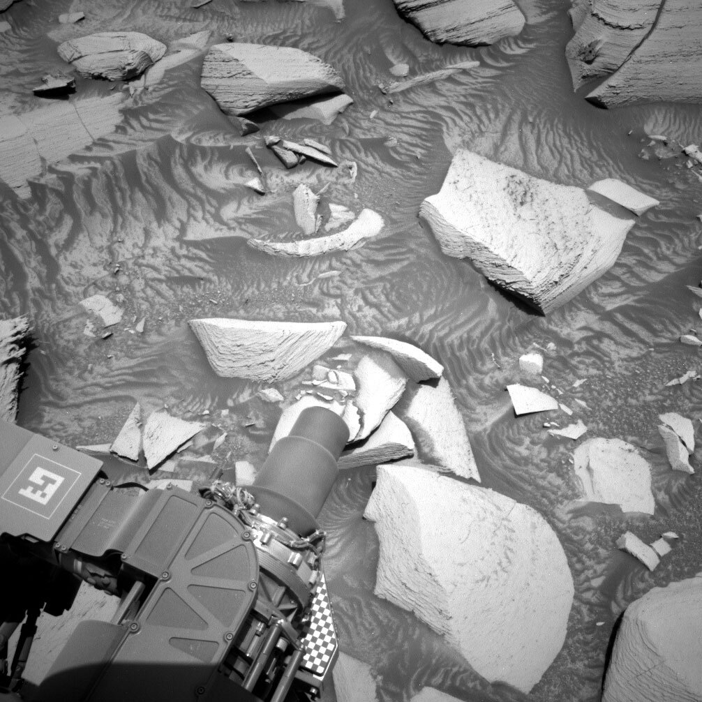
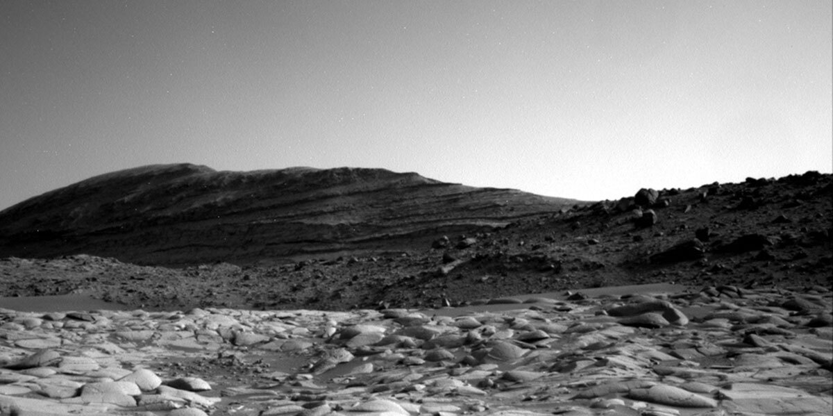
This image was taken by Right Navigation Camera onboard NASA's Mars rover Curiosity on Sol 4083. Credits: NASA/JPL-Caltech. Download image ›

Earth planning date: Wednesday, January 31, 2024

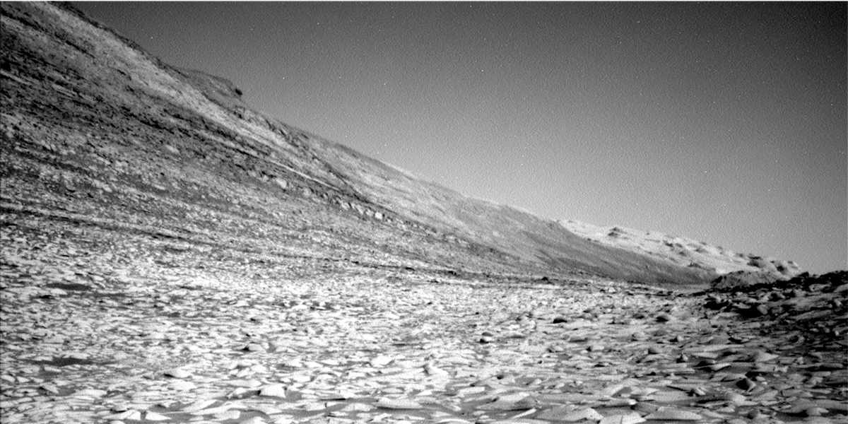
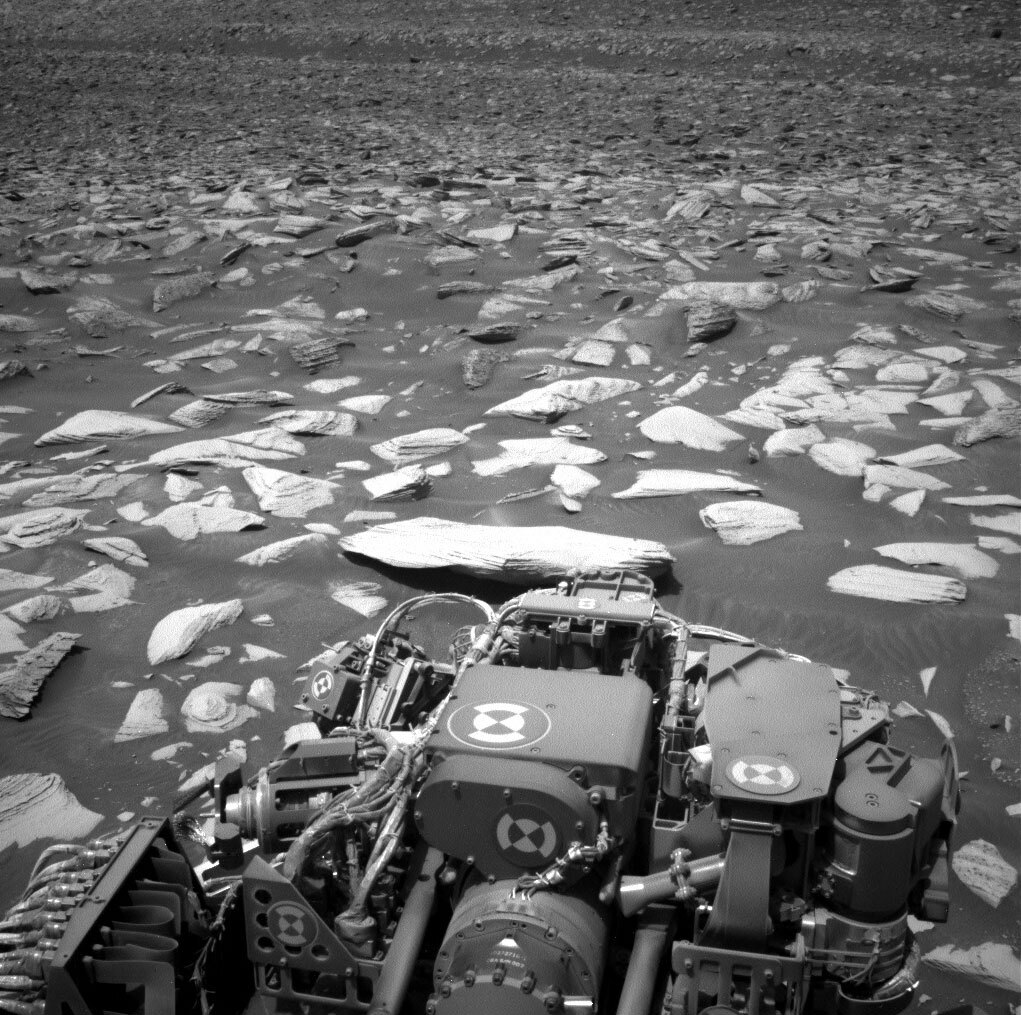
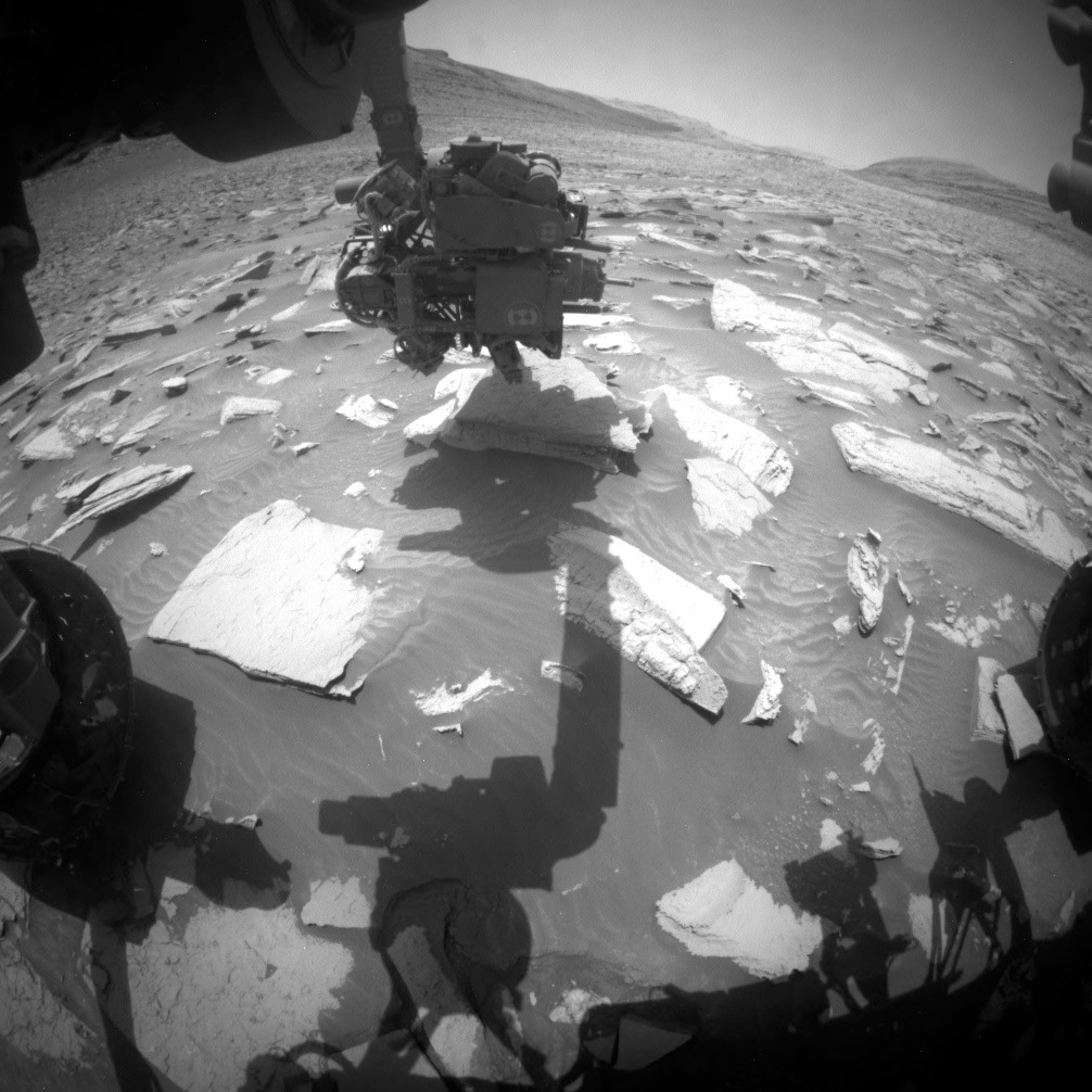
Curiosity continues her investigation of the light and dark banded sulfate terrain and started this two-sol planning day with several beautiful rocks within arm’s reach. The rover is tantalizingly close to the base of the upper Gediz Vallis ridge and the team is very excited for the spectacular geology ahead.

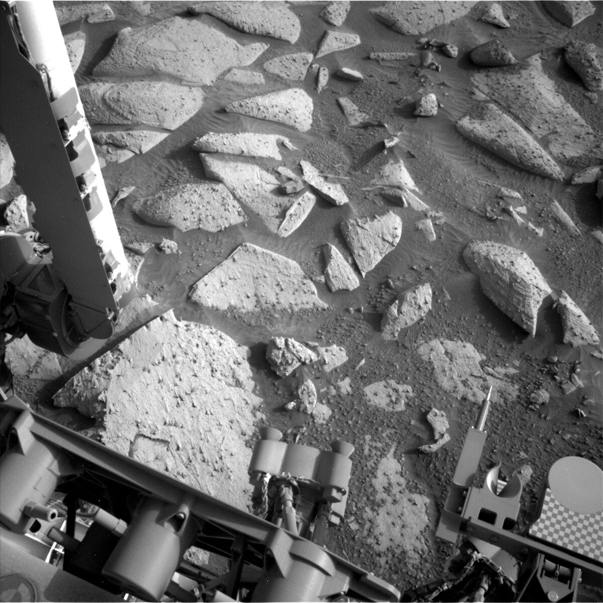
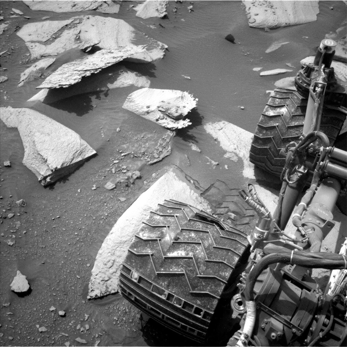
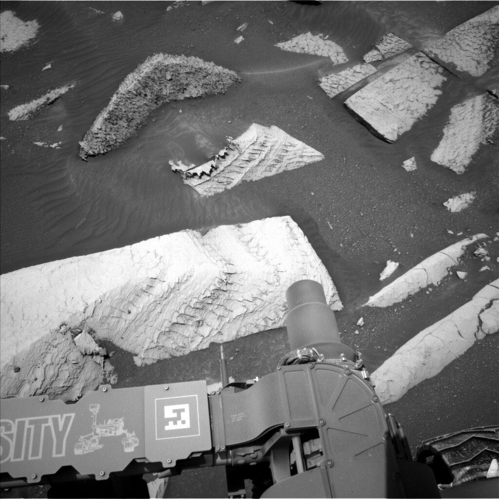
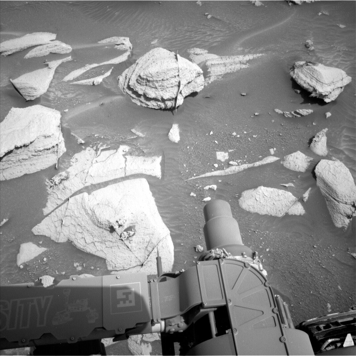
Today I served as the Geology Keeper of the Plan where I recorded all the details of the science activities that were proposed by science and instrument team members. We kicked off planning for sol 4084 by analyzing a finely layered rock named "Grizzly Lakes" with the dust removal tool (DRT), APXS, and MAHLI imaging. Just beyond "Grizzly Lakes," ChemCam and Mastcam teamed up to characterize a crescent-shaped rock, "Gorge of Despair," to investigate flakey dark material standing in relief on the surface of the rock. The Mastcam team created a mosaic of the workspace in addition to three mosaics that characterized the local bedrock and sand at "Roads End," "Knapsack Pass," and "Rae Lake." Mastcam also took a mosaic of "Round Lake" to image what is likely a small impact crater. We pushed the plan to the limit by including two long distance ChemCam RMI images of a dark band in the distance, and an outcrop along the upper Gediz Vallis Ridge to characterize the variety of rocks. Lastly, we included a Navcam mosaic of the view behind the rover to document several of the layers and buttes in Chenapau, Orinoco, and Kukenan that we drove by in recent months.

And then we hit the road! We planned a 10-meter drive that will put Curiosity on a topographic bench that should provide a mouth-watering vantage point to document a section of the upper Gediz Vallis ridge that is informally named "Fascination Turret." We hope to evaluate the processes that deposited the sediment in this ridge to understand how it formed and how it was later eroded to its present-day form.

On Sol 4085 we scheduled a ChemCam AEGIS activity; AEGIS is an acronym for Autonomous Exploration for Gathering Increased Science and is a mode where the rover identifies and selects a geological target from navigation camera images based on a set of guidelines set by scientists back here on Earth. Several environmental observations are included in the plan to monitor dust devil activity as well as zenith, suprahorizon, and Tau observations that will measure the amount of dust in the atmosphere.

January 30, 2024

Sols 4082-4083: A New Perspective

Written by Alex Innanen, Atmospheric Scientist at York University
This image was taken by Right Navigation Camera onboard NASA's Mars rover Curiosity on Sol 4080.

This image was taken by Right Navigation Camera onboard NASA's Mars rover Curiosity on Sol 4080. Credits: NASA/JPL-Caltech. Download image ›

Earth planning date: January 29, 2023

Curiosity is continuing to climb our weekend drive delivered us to a new location with lots new to see for today’s two sol plan. This includes views of the upper Gediz Vallis Ridge that we haven’t been able to see before, and a brand new workspace right in front of us to explore before we drive off on the second sol.

We’re taking full advantage of the new view that our location affords us with a lot of contact science on the first sol. We’ll use the dust removal tool on both "June Lake" and "Martha Lake", two targets on the same block that will be investigated by MAHLI and APXS. MAHLI will also be examining "Deerhorn Mountain", a dark feature that may be embedded in the same block. ChemCam is also getting in on the up-close science with LIBS on "June Lake", and the slightly further afield "Sky Blue Lake", a fractured rock.

Further afield, Mastcam and ChemCam are both capturing mosaics of the upper Gediz Vallis Ridge, continuing to fill in our picture of this feature that we’ve been alongside for so long. From reading through these updates, it may sound like we’re imaging the Gediz Vallis Ridge almost every sol, but it’s a huge feature and as we continue alongside it there’s always more to see, including this new perspective we got today. Mastcam also has a couple more mosaics closer by on the ChemCam LIBS target "Sky Blue Lake" and "Tokopah Falls", a bedrock in the midground with a raised vein.

As Deborah said on Friday, we’ve crossed the threshold into the time of year where we’ve seen global dust storms, the environmental theme group is keeping an eye on the dust situation. We have a few tools to help us with this in today’s plan this includes a 360 degree dust devil survey, two line-of-sight observations looking at the amount of dust in the crater, and a tau looking at the total amount of dust in the atmospheric column. We’re also getting a suprahorizon movie, which is normally used for clouds but has been known to catch dust movement too.

January 30, 2024

Sols 4079-4081: Shaking Out the Dust

Written by Deborah Padgett , OPGS Task Lead at NASA's Jet Propulsion Laboratory
This image was taken by Left Navigation Camera onboard NASA's Mars rover Curiosity on Sol 4078.

This image was taken by Left Navigation Camera onboard NASA's Mars rover Curiosity on Sol 4078. Credits: NASA/JPL-Caltech. Download image ›

Earth planning date: Friday, January 26, 2024

Welcome to Spring in Gale Crater! The spring equinox in the southern hemisphere on Mars has arrived, beginning another potential global dust storm season. Martian southern summer, between now and September on Earth, is the time when all global dust storms on Mars have been observed to start. Although these huge atmospheric events are generally separated by many years, the last sky-darkening global Martian dust storm in 2018 ended the mission of our beloved Opportunity Rover. Starting now, Curiosity’s environmental science team is on alert to measure atmospheric dust levels more frequently throughout this season. We are also going to try another activity to move the filter wheel on the left Mastcam. The right Mastcam camera is still healthy and fully capable of doing its science, but the team wants to recover the wider field of view of the left camera.

Curiosity's contact science on "Sierra Columbine" and drive on sol 4078 completed successfully. On sol 4079, Curiosity will perform two dust removals, MAHLI microscopic imaging, and APXS composition measurements on nodular bedrock targets "Simpson Meadow" and "Lake Sabrina." The first target honors an expansive meadow, known for its dangerous trail crossing of the often raging Middle Fork Kings River in Kings Canyon National Park. The second is named for a spectacular, sheer-walled reservoir in the upper reaches of Bishop Creek Canyon, favorite of hikers, rock climbers, and trout. All targets in this area of Mount Sharp are named after the Bishop geological quadrangle in the High Sierra and Owens Valley of Calfornia, familiar to students of late Caltech geology Professor Robert Sharp. Mastcam will image the "Orinoco" butte behind Curiosity, as well as targets "Paradise Peak," "Big Arroyo," and some nearby troughs between the rocks. Mastcam and the ChemCam laser will also target "Minaret Vista," named for an iconic viewpoint near Mammoth Mountain which overlooks the San Joaquin River canyon in Devil’s Postpile National Monument. The ChemCam RMI telescope will map stratigraphy on the Kukenan butte. Atmospheric observations on this sol include a dust devil survey and an APXS measurement of argon and other atmospheric constituents. Curiosity starts Sol 4080 by completing science documentation of this stop with a ChemCam LIBS + Mastcam observation of "Pinchot Pass," a dark nodule named for an outstanding 12,000 ft alpine pass on the John Muir Trail. This is followed by a ChemCam passive sky and 10x1 RMI panorama of upper Gediz Vallis Ridge. Curiosity then will start driving, while simultaneously commanding the Mastcam left filter wheel to move. After the drive ends, Curiosity will perform its usual post drive panoramic imaging, and Mastcam will look for filter wheel motion with a left camera image. On the third sol of the plan (4081), ChemCam will perform a set of AEGIS observations at the new stop, followed by Navcam and Mastcam atmospheric dust opacity measurements, Navcam cloud movies, and a Navcam dust devil movie. On Monday, the Curiosity team will do contact science at the new location, then drive on. The attached image shows a Navcam image of our road ahead.

January 25, 2024

Sol 4078: Polka Dots and Sunbeams

Written by Michelle Minitti, Planetary Geologist at Framework
This image showing some of the Curiosity rover's instruments above the Mars surface was taken by Left Navigation Camera onboard NASA's Mars rover Curiosity on Sol 4076.

This image was taken by Left Navigation Camera onboard NASA's Mars rover Curiosity on Sol 4076. Credits: NASA/JPL-Caltech. Download image ›

Earth planning date: Wednesday, January 24, 2024

We arrived at a workspace with bedrock delightfully dotted with resistant features whose granular appearance and gray color were intriguing enough to warrant attention from APXS, ChemCam, and MAHLI. ChemCam will target one of these features, "Tehipite Dome," while MAHLI and APXS will target a different feature on the same block, "Sierra Columbine," after DRT brushes it. When we are investigating such features, the more data the better!

ChemCam also planned long distance imaging of two of the features dominating our skyline — the "Kukenan" butte and the Gediz Vallis Ridge. The mosaics had to be carefully planned to avoid any risk of sun getting into the ChemCam optics — what we colloquially refer to as "sun safety." The mosaics balance sun safety with imaging the exact features of interest on each rise — a delicate dance to achieve great science!

Mastcam joined in imaging of the Gediz Vallis Ridge, overlapping the ChemCam-targeted area to provide context and additional coverage. Mastcam’s other planned mosaics focused closer to the rover, capturing different structures and features of interest. "Frozen Pass Lake" looks at the light and dark banding we have been exploring from our current perspective on it. "Rough Spur" captures a near-vertical vein that sharply divides a bedrock block. On one side of the vein, the bedrock exhibits thin layers, but on the other side of the vein, the bedrock is structureless. The "Mule Ears" bedrock block has multiple subparallel veins that artfully fan out through the block.

Before the rover drives further south and uphill for the weekend, Navcam will look for dust devils and clouds near midday. DAN passive, REMS, and RAD run before, during and after the drive, and REMS and RAD continue long into the wee hours before the next plan begins. Once we are settled in at our next, hopefully equally delightful workspace, Navcam and Mastcam will measure the amount of dust in the atmosphere in the late afternoon and MARDI will image the terrain beneath the rover near twilight. Whatever will we find next?

January 23, 2024

Sols 4076–4077: Driving Into Springtime

Written by Conor Hayes, Graduate Student at York University
This image of the rover wheels above the Mars surface was taken by Left Navigation Camera onboard NASA's Mars rover Curiosity on Sol 4074.

This image was taken by Left Navigation Camera onboard NASA's Mars rover Curiosity on Sol 4074. Credits: NASA/JPL-Caltech. Download image ›

Earth planning date: Monday, January 22, 2024

Here in Toronto (along with much of Canada and the United States), we've spent the last few weeks bathed in an icy blast of arctic air, which has been quite a dramatic contrast with the very mild winter that we've had up until now. However, it is starting to warm back up, not just here but on Mars as well. We're just past the halfway point of the current Mars Year (numbered 37 in the system created by Todd Clancy in 2000), meaning that springtime has now arrived at Gale. Mars is also rapidly approaching perihelion, or its closest distance from the Sun. At this time of year, daily maximum temperatures typically hover just below freezing, not dissimilar to Toronto today. These higher temperatures can be very helpful for us during planning, as they mean that we have to spend less of our power on heating Curiosity's instruments, leaving more for us to do science with!

Both science theme groups made good use of the favourable power situation, fitting in just about three hours of activities between the two sols we planned today. We begin with an early-morning investigation of the target "Manzanita," first using DRT to clear away the ubiquitous Martian dust before placing APXS atop it. With the arm pulled away from Manzanita, we move on to ChemCam, beginning with LIBS on "University Peak." ChemCam RMI will then take a mosaic of a region of Kukenán (the large butte that forms the eastern wall of Gediz Vallis) south of where the rover is currently parked. Once ChemCam has finished its work, it's Mastcam's time to shine, starting with a set of images to document the results of the University Peak LIBS activity. Mastcam will then take a look off in the direction that we plan to drive, and finish off by documenting some sedimentary layers at "Trail Crest" and searching for polygonal fracturing at "Atwell Grove." Before driving away from this location, we get up close and personal with Manzanita one more time, brushing it again with DRT and imaging it with MAHLI.

The second sol of this plan begins with ChemCam. Because we don't know exactly where the rover will be parked following the drive on the first sol, we can't select LIBS targets for the second sol in advance. Instead, the rover will do that itself, autonomously choosing targets based on a set of parameters provided to it. The second sol will finish off with some remote sensing of the atmosphere, including a lengthy half-hour Navcam movie to look for dust activity north of our current location and Mastcam imaging of the sky to measure the amount of dust in the atmosphere.

January 19, 2024

Sols 4073-4075: A Fractured Filled Plan

Written by Catherine O'Connell-Cooper, Planetary Geologist at University of New Brunswick
Sol 4071 Left Navcam image, showing the “Moraine Lake” block just in front of the rover and the darker toned “Penstemon” block behind it, on the right.

Sol 4071 Left Navcam image, showing the “Moraine Lake” block just in front of the rover and the darker toned “Penstemon” block behind it, on the right. Credits: NASA/JPL-Caltech. Download image ›

Earth planning date: Friday, January 19, 2024.

This 3 sol weekend plan, like many of our recent plans (for example: here and here), focuses heavily on the fractures and cracks in this area. We are interested in cracks and fractures and the fracture fill (the material between cracks) as the chemistry and the physical features can tell us lots about conditions at the time of their formation, including environmental conditions and timing of the cracks, relative to each other and the host bedrock. The polygonal fractures we saw last week are not as well developed here but there are so many other textures here to work with.

First we will focus on the large block at the front of the workspace. APXS will examine the brushed bedrock target “Mount Langley,” an area without any obvious fractures on the top of the slab to determine the bulk chemistry of the rocks in this area. Then we look at fracture fill in “Sleeping Beauty's Tower” in one of the sub-vertical parallel lines or fractures (crosscutting the horizontal layers) along the side of the large block. In addition to the typical MAHLI imaging of a science target, the MAHLI team opted to add frames around this target, giving even more topographic information. ChemCam will use LIBS to look at “Moraine Lake,” an area of polygonal features on the top of the block, and Mastcam will image the whole block. ChemCam will also use LIBS on “Penstemon,” a rather gnarly looking smaller block in the workspace, and take a passive raster on layering at “Vidette Meadow.”

Mastcam will take several other mosaics. The “Chickenfoot Lake” mosaic is a 7 by 4 mosaic (4 rows of 7 slightly overlapping images) covering another area of polygons to the left of the immediate workspace. “Diaz Pass” is a smaller (4x2) mosaic focused on a linear zone of shattered appearing rock, surrounded by large bedrock blocks, roughly 17 metres on the right-hand side of the rover. On Tuesday, Mastcam imaged potential polygons in the “Incense Cedar” target; today, we will take a further 3x2 mosaic of the same target, looking this time at some bedding layers side-on. Further afield, the ChemCam RMI will be used to study the stratigraphy at the base of the large butte “Texoli” and an area along the Gediz Vallis ridge.

Of course, geology is not the only focus for this plan – the environmental theme group (ENV) have several activities too. REMS will measure temperatures, whilst Mastcam solar taus monitor the dust in the atmosphere, allowing us to track any increases or decreases in dust content. A series of movies looking for dust devils and for dust in out towards the crater rim will be carried out over the three sols of the weekend plan.

All this and a drive too – heading onwards to see where we end up next!

January 17, 2024

Sols 4070-4072: So Many Textures, So Little Time

Written by Ashley Stroupe, Mission Operations Engineer at NASA's Jet Propulsion Laboratory
Nasa's Mars rover Curiosity acquired this image using its Left Navigation Camera on Sol 4068, at drive 1684, site number 105

This image was taken by Left Navigation Camera onboard NASA's Mars rover Curiosity on Sol 4068. Credits: NASA/JPL-Caltech. Download image ›

Earth planning date: Tuesday, January 16, 2024.

After a long holiday weekend, Curiosity is back hard at work. The first sol of the plan begins with some spectroscopy and imaging. ChemCam LIBS is doing a 5-spot observation of the target “Rovana,” which is a bedrock target. We then take a 10-frame RMI of “Texoli,” which is a layered butte to the south of the rover. Mastcam also images Rovana, as well as taking mosaics on two fractured bedrock blocks, “Shepherd Creek” and “Richter Creek,” and “Incense Cedar,” which is a polygonally fractured block in the direction in which we are heading. Navcam also takes some atmospheric observations, including a dust devil movie and a line-of-sight image.

After a few hours of napping, Curiosity will be ready to get her arm exercise in. There are two types of blocks in the workspace – one which looks smooth and the other that looks layered (laminated). The Science Team requested brushing and looking at both types of rock. They are hoping to be able to measure grain size, which helps us understand how the rocks were formed. The Arm Rover Planner had a very challenging time finding spots on both types of blocks that were smooth enough that we could brush them to clean them off. Ultimately, with the help of another Rover Planner, suitable targets were found for each rock texture, though the brush on the laminated target had to be centered on some smaller, less prominent lamination to be safe. The unlaminated target is named “Sheelite,” and “Dorst” is the name of the laminated target. Both targets will be brushed prior to taking MAHLI images and evening APXS integrations. After all the arm observations are complete, the rover will stow the arm to be ready to drive on the next sol and go to sleep.

The next morning, on sol 4071, Curiosity kicks off almost 8 hours of DAN passive measurement in parallel with more spectroscopy and imaging. ChemCam uses LIBS to observe the Dorst contact science target, and then takes RMI mosaics of Incense Cedar and “Aspen Springs,” which is a distant target that may have an exposed vertical stratigraphic section, showing a longer period of history at that location. Mastcam follows up by imaging Dorst, and then Navcam takes a suprahorizon movie to monitor atmospheric conditions. Finally we take a Navcam high-resolution 6x1 mosaic as an experiment to combine with the Mastcam M100 to get both stereo and color.

Next, Curiosity gets on the road, driving toward a nearby block that is our next contact science target. The block is part of the “Painted Lady” area which has a lot of polygonal features in the rock. The included image shows the area into which we are driving. The terrain here continues to have a lot of larger rocks and a lot of small pointy rocks that can damage Curiosity’s wheels; there is also a bit of a slope and some sand. Even though the rock is only 7m away from us, the difficult terrain is forcing us to take a less-direct, longer path.

After the drive, we take our standard post-drive imaging to look at our new workspace and the direction of the next drive. We then do a three hour Navcam atmospheric observation, which we hope might catch a dust devil in the late afternoon. We drop in this observation when we want the rover to stay awake to keep her from overcharging her batteries. After a twilight MARDI image of the ground underneath the rover, Curiosity sleeps for the night.

On the last sol of the plan, we have a short block of untargeted science. We’re taking a ChemCam AEGIS observation to autonomously look for something interesting nearby as well as some Navcam atmospheric line-of-sight imaging.

January 16, 2024

Sols 4064-4066: A Bird in the Hand...

Written by Emma Harris, Graduate Student at Natural History Museum
This image was taken by Front Hazard Avoidance Camera (Front Hazcam) onboard NASA's Mars rover Curiosity on Sol 4062.

This image was taken by Front Hazard Avoidance Camera (Front Hazcam) onboard NASA's Mars rover Curiosity on Sol 4062. Credits: NASA/JPL-Caltech. Download image ›

Earth planning date: Wednesday, January 10, 2024

Today the science team members were excited about having reached an area of polygonal fracturing in the workspace. Unfortunately, due to possible rover instability we were unable to unstow the arm safely and thus, no contact science today. The image above shows the unstowed arm performing contact science on a previous target "Chagoopa." A discussion arose, debating whether we should slightly reposition here — known as a 'bump' — into a good place for contact science, or if we should keep driving onwards and upwards. Ultimately, the discussion concluded 'a bird in the hand,' and we chose to slightly readjust and bump here in preparation for contact science during the upcoming weekend plan.

A lack of contact science today meant remote sensing science could have a field day! Today we planned 1.5 hours of remote activities, beginning with a ChemCam LIBS on the polygonal fractures on target "Evolution Valley." Geo also planned two long distance ChemCam RMIs of upper Gediz Vallis Ridge. The Mastcam team were able to complete every request for an image in the time we had today, including six bedrock targets all named creek: "Cartridge Creek," "Carroll Creek," "Cataract Creek," "George Creek," "Hogback Creek," and "Pinyon Creek." The planned science on this first sol ends with a Navcam suprahorizon movie.

After the targeted science, the rover is on the move — although not very far! We’ll bump here ready for a whopping 3 hours of planned science over the weekend, hopefully including contact science on the polygonal fractures in this workspace. On the second sol of this plan the rover will automatically take a ChemCam LIBS target to maximise science return and Navcam will search for dust devils. Here’s to a wonderful weekend full of science and making the most of this bird in the hand.

January 16, 2024

Sols 4066-4070: Cracking Up!

Written by Lucy Thompson, Planetary Geologist at University of New Brunswick
Navcam left image of the current workspace. The block immediately in front of the rover (slightly left of centre) is the focus for many of our observations in this plan.

Navcam left image of the current workspace. The block immediately in front of the rover (slightly left of centre) is the focus for many of our observations in this plan. Credits: NASA/JPL-Caltech. Download image ›

Earth planning date: Friday, January 12, 2024

Cracking up — not Curiosity, but the rocks! It is all about the cracks and fractures in the workspace for this 4-sol plan. We have observed resistant, polygonal fractures/ridges in many recent bedrock blocks. There is much speculation among the team as to the origin of these features. Hypotheses have different implications for past environments, and the polygonal fractures are therefore of high interest. As well as the polygonal fractures, there are more continuous linear veins. The relationship between the polygonal and linear fractures can also help to inform our interpretations. In order to investigate both hypotheses, we planned multiple chemical and imaging observations of the polygonal features and linear fractures/veins in this jam-packed 4-sol holiday plan.

ChemCam will shoot its laser at examples of linear veins ("Soda Creek" and "Windy Ridge") and polygonal fractures ("Monola"), and we will capture these targets within a Mastcam mosaic. The arm instruments will also be in on the action! As the APXS strategic planner today, I proposed a 4-spot APXS/MAHLI raster across an intersection of some of the polygonal ridges/fractures ("Split Mountain") to investigate their composition and texture versus the substrate bedrock. This resulted in the plan being a little more complex than usual, but the rover engineers at JPL rose to the challenge and managed to accommodate our request. MAHLI will also image the "Great Western Divide" linear vein — polygonal fracture/ridge intersection. To document other examples of linear veins and polygonal features a little further afield Mastcam will acquire images of: the previous "George Creek" and "Hogback Creek" targets to enable stereo imaging; an area in the vicinity of the previous "Isosceles Peak" target; and the area around the "Taboose Creek" target. Not everything is “cracking up” though! CCAM will also acquire long distance RMI mosaics of the Kukenan butte, and the "Ragged Spur" dark patch of bedrock. After a planned drive to the east of our current location, we will image the terrain beneath the wheels with MARDI.

Not to be outdone, the environmental scientists also have abundant activities and observations in this bumper holiday plan. The first sol is devoted to coordinated ChemCam passive, SAM, and APXS atmospheric observations as well as a Mastcam tau to measure the amount of dust in the atmosphere. We are also acquiring a Navcam dust devil movie, a zenith movie, and supra horizon and line of sight imaging. Standard REMS, RAD and DAN activities round out the plan.

January 9, 2024

Sols 4062-4063: Ready for Contact Science

Written by Abigail Knight, Graduate Student at Washington University
This image was taken by Left Navigation Camera onboard NASA's Mars rover Curiosity on Sol 4060.

This image was taken by Left Navigation Camera onboard NASA's Mars rover Curiosity on Sol 4060. Credits: NASA/JPL-Caltech. Download image ›

Earth planning date: Monday, January 8, 2024

With a successful bump backwards over the weekend, Curiosity is now positioned to execute contact science on a flat block of dark-toned bedrock in its workspace and continue investigating the composition and texture of the dark bands we’ve been observing from orbit. Our two-sol plan starts with a DAN passive, followed by brushing of the contact science target "Chagoopa" and a brief APXS integration on the target. Up next, we have our morning science block with ChemCam observations of "Chagoopa," target "Painted Lady" (an outcrop of fractured bedrock with an interesting polygonal texture), and a long-distance RMI of Milestone Peak (a deposit with large boulders). Mastcam has planned observations of "Chagoopa," "Saddlerock Lake" (an exposed truncation surface with a possible ventifact), and "Rock Creek" (fractured rock), as well as an AEGIS activity. Mastcam will then image the Dust Removal Tool, and MAHLI will acquire imagery of "Chagoopa" from 25 cm, 5 cm, and 2 cm away.

After the morning science block, Curiosity will drive about 16 m to some polygonal fractured material, and MARDI will perform a video activity to document the fractures. Following this, we have post-drive imaging to assist the Rover Planners, identify targets for the next plan, and systematically document clasts and soils along the traverse. MARDI will acquire a single image at twilight to close out the first sol of this plan.

The second sol begins with another DAN passive and an untargeted science block in the morning. This science block includes ChemCam AEGIS of bedrock, a Navcam line-of-sight observation, and a Navcam dust devil movie. The planned contact science observations of the dark-toned bedrock target in our workspace will inform a decision on potentially drilling the rocks in this region again or not.